


DALLAS – A cold front approaching the Metroplex this weekend will bring an end to recent high temperatures. Showers are possible through Sunday.
Friday Forecast
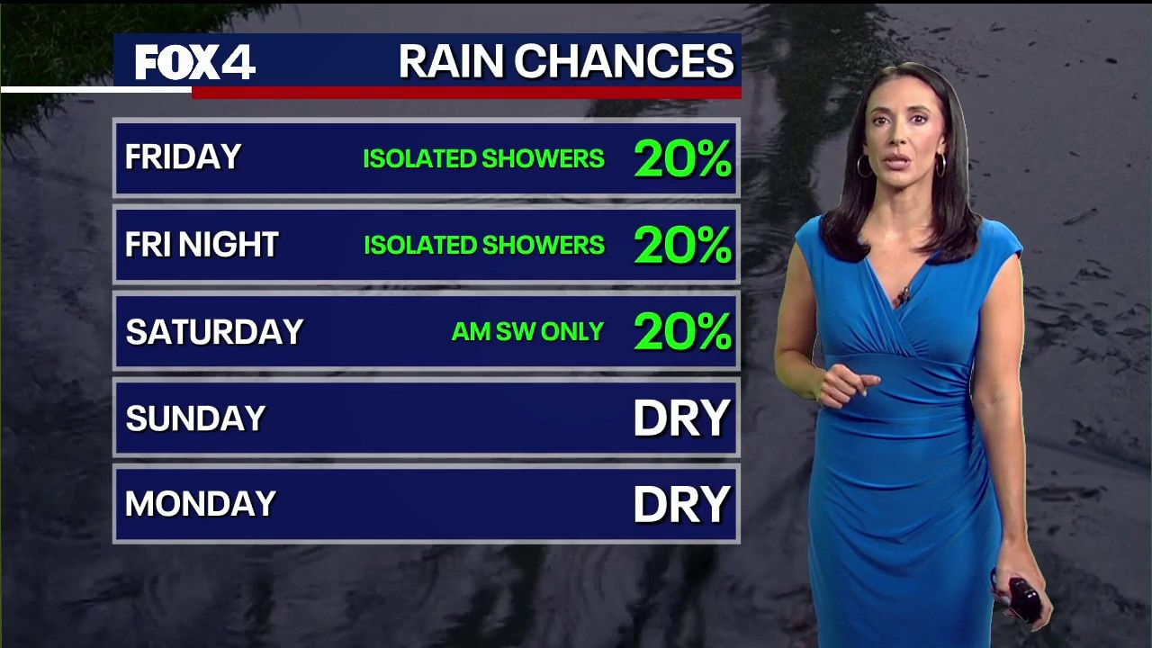
A North Texas cold front will move through late Friday morning and into the afternoon. Temperatures will be significantly cooler north of the Dallas-Fort Worth area, with highs ranging from the mid-60s to upper 70s. North winds could gust up to 35 mph behind the front.
Much cooler temperatures and a slight chance of rain will follow the front. There is a 30% chance of showers in the DFW area around 8 p.m., with overnight lows falling into the 40s and 50s.
Weekend Forecast
Cooler air settles in Saturday, with highs reaching only the low to mid-60s. There is a 20% to 40% chance of light showers Saturday morning, though rainfall totals are expected to be minimal.
By Sunday, south winds and sunshine return as highs climb back into the low 80s.
7-Day Forecast

Heading into next week, a ridge of high pressure will shift east. This shift will allow disturbances to the west to bring rain chances back to North Texas. Highs on Monday and Tuesday could approach 90 degrees.
Allergy Levels Remain High

Tree pollen levels in North Texas remain very high, while ragweed levels are moderate. Mold and grass pollen levels are currently low.
During peak tree pollen season, experts recommend keeping windows and doors closed, especially on windy days. Residents should avoid outdoor activities in the early morning and shower after coming indoors. Allergy medication can also help alleviate symptoms, according to AccuWeather.
The Source: Information in this article comes from FOX 4 Forecasters, the National Weather Service and AccuWeather.
